


As the National Park Service turned 100 years old in 2016, “Find Your Park” became the rally cry of the Centennial celebration, and for a record-shattering 11.3 million people, their park was the Great Smoky Mountains.
Sprawling across the border of Tennessee and North Carolina, the Smokies earn the title of our most visited National Park year after year, consistently welcoming an average of 9+ million visitors. The Smokies boast nearly 850 miles of trails, but at times—especially during the park’s busiest months of June, July, August and October—the trails feel more like pedestrian highways.
If you’re planning a trip to these beloved mountains and want to avoid crowded trails, I highly recommend grabbing your Park map and hiking guide and adding one (or more!) of these underrated Great Smoky Mountains hiking trails to your itinerary.
Baskins Creek Trail to Baskins Creek Falls
3.2 miles to the falls and back
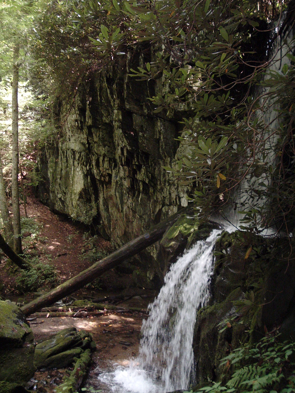
Waterfall hikes are among the most popular in the Smokies, but Baskins Creek Falls is the overlooked middle child when it comes to the waterfalls located off the Roaring Forks Motor Nature Trail. The trailhead is two-tenths of a mile from the beginning of the motor trail and is very easy to miss. This moderate trail requires a few water crossings, and the majority of the trail is spent hiking down to the falls, with an especially steep final descent—meaning the return trip to the trailhead is an uphill challenge. While the falls themselves are the recommended destination, highlights along the way include mountain views (obscured in the summer months) and the small Baskins Creek Cemetery. Additionally, this Great Smoky Mountains hiking trail traverses areas burned by the November 2016 wildfire, giving hikers a unique glimpse of nature gracefully rebounding from ashes.

Metcalf Bottoms/Little Brier Gap Trails
4.0 miles to the Walker Sisters’ Cabin and back
A seasonal road bypasses the first portion of this historical hike, but those looking for more time to connect with nature should park at the Metcalf Bottoms picnic area and start their journey with the easy 0.7-mile creekside Metcalf Bottoms Trail to the heart of the former Little Greenbrier community, marked by the Little Greenbrier Schoolhouse and nearby cemetery. From here, the Little Brier Gap Trail gradually climbs as it follows what used to be a country road. At roughly the 1.1 mile mark, the old road and present-day trail split ways; follow the old road to the right for another two-tenths of a mile to the Walker Sisters homestead. The Walker Sisters were the last living residents within the National Park boundaries, with the last sister passing away in 1964.

Middle Prong Trail
8.2 miles to Indian Flats Falls and back
As visitors make their way to the Park’s popular destination of Cades Cove, they pass by an unassuming road that leads to, in my opinion, one of the richest sections of the Park—Tremont. The trailhead for the Middle Prong Trail is found at the end of a gravel road that meanders through Tremont, and the views along this road are just a small taste of what awaits along the trail. The wide trail steadily climbs along an old railroad bed, offering hikers splendid views of several cascades along the way. One of the more unique sights along the trail is located just before the 2 mile mark: a rusted 1920s/1930s Cadillac. Other remnants of man’s presence from decades past are dotted along the trail—an old chimney, stone walls, an old railroad beam. The second portion of this Great Smoky Mountains hiking trail is considerably steeper and a bit more rugged than the first half, but at roughly the 4 mile mark, an unmarked manway continues right to the hike’s destination of Indian Flats Falls.

*Bonus tip: While I won’t divulge exact details, research another waterfall located in Tremont that I consider to be THE best kept secret in the Smokies!
Old Sugarlands Trail to Sugarlands Cemetery
3.8 miles to the cemetery and back
The Old Sugarlands Trail is more than a journey into the woods—it is a journey back in time. The trailhead is located just off of Newfound Gap Road, roughly 200 yards north of the Sugarlands Visitors Center, yet very few visitors even know this Great Smoky Mountains hiking trail exists. Ambling along a riverbank, the trail itself is relatively level, and the lower section follows an old highway into the heart of one of the oldest communities that once thrived in the Smokies. Old home foundations, chimneys and rock walls along the trail allude to the early Sugarlands settlement, and interesting remnants of an old Civilian Conservation Corps camp—including an old clock tower, an old dam and former parade grounds—are also buried in the woods not too far from the trail’s edge. The hike’s recommended destination, the Old Sugarlands Cemetery, is the final resting spot for many prominent members of the early community.

About the Author: Kimberly Weber is a National Parks lover and creative marketer


